


Målebåter app for iPhone and iPad
4.0 (
7200 ratings )
Travel
Navigation
Developer: Electronic Chart Centre
Free
Current version: 1.1.0, last update: 7 years agoFirst release : 23 Jan 2014
App size: 2.73 Mb
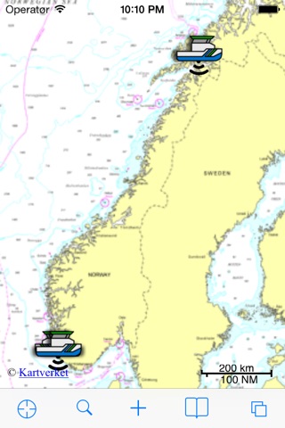
Track the movements of the survey vessel and launches mapping the Norwegian waters, under the auspices of the Norwegian Mapping Authority Hydrographic Service (NHS).
The location of the survey vessel and launches are updated in accordance to the Norwegian Coastal Administration’s satellite-based AIS (Automatic Identification System) data.
The app is developed in cooperation between the Norwegian Mapping Authority Hydrographic Service and Electronic Chart Centre (ECC).
More information about the Norwegian Mapping Authority is available at kartverket.no.